roger.pape
Site Admin
Joined: 17 Mar 2009
Posts: 414
Location: Liverpool, NY
|
 Posted: Sat Apr 08, 2017 11:26 am Post subject: Early photo of Concordia? Posted: Sat Apr 08, 2017 11:26 am Post subject: Early photo of Concordia? |
 |
|
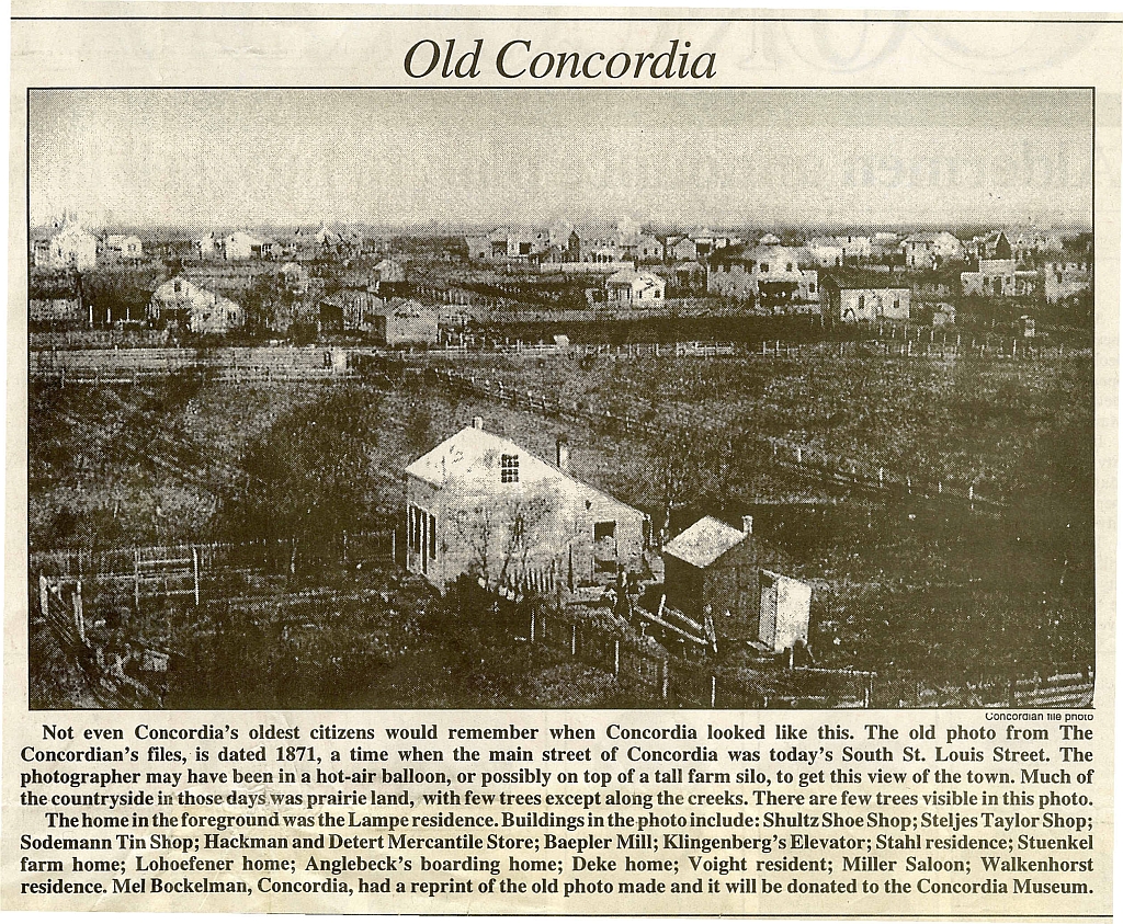
The early photo of Concordia shown below has always been puzzling to me. Has anyone tried to identify the contents of that photo? It appeared in a Concordian article which provided some information about it. The location from which the picture was taken and the direction in which the camera was pointed are not identified. Based on the direction in which most buildings face (which would be east and west since the major streets like St. Louis and Schiller ran north-south), one would conclude that the left of the photo is south and the right would be north. So the view should be from the east of Concordia looking west. Where there any tall silos or windmills in that area from which one could be looking down? If one assumes the view is looking to the east, the first street would have to be Bismark St., rather than St. Louis St., and the buildings make even less sense. The area just west of Concordia had been open fields from the earliest times.
The Concordian article mentions a number of homes and buildings that are purported to be in this picture. (Who identified these buildings is not indicated.) However, there appear to be a number of inconsistencies.
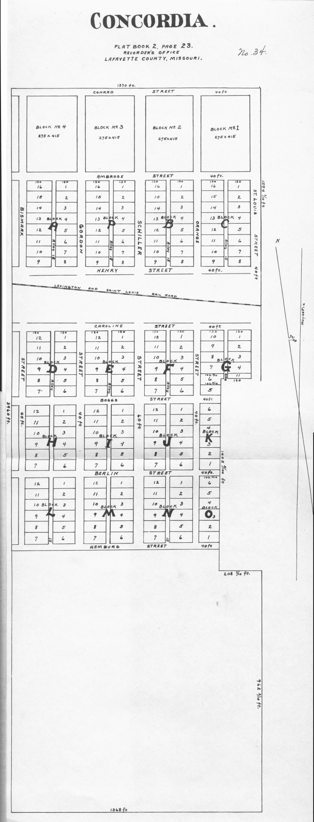
First of all, the photo was dated as having been taken in 1871. That was three years after Concordia was platted and incorporated. A copy of the plat that was filed in 1869 is shown below. Note that if shows the "Lexington and Saint Louis Railroad" running through the center of the town. While one might argue that it simply shows plans for the railroad, the records of the railroad state that the entire section between Lexington and Sedalia was completed in 1871. So where are the railroad tracks in this photo? They should be running from the bottom left to the top center. It could be said that it is off to the right, but not if the Conrad Stuenkel farm is in view. [Note. I've tried flipping the photo over, but that doesn't seem to help.]
The Concordian article also states that the Baepler Mill is shown in the picture. This mill was on Bismark St. and was not built until 1877. Which Klingenberg Elevator does the article cite? The elevator close to Baepler Mill was built slightly later.
Looking through the 1870 Freedom Township census, one can find most of the names mentioned in the newspaper article. But these were names supplied by someone and not identified in the photo.
The church on the left of the photo appears to be the old Baptist Church on South Gordon St. which was not built until 1889 although there apparently was an earlier one built around 1873. Bethel Evangelical Church was organized in 1872 when its first church was built.
I'm beginning to doubt whether this was Concordia. Other people have looked at it and are as puzzled as I am. Surely, someone has further information to identify the source of the photo.
| Description: |
| Old photo of Concordia (?) from The Concordian |
|
| Filesize: |
891.61 KB |
| Viewed: |
17595 Time(s) |

|
| Description: |
| Copy of original plat of Concordia filed 1869 |
|
| Filesize: |
538.42 KB |
| Viewed: |
17595 Time(s) |

|
|
|


