roger.pape
Site Admin
Joined: 17 Mar 2009
Posts: 414
Location: Liverpool, NY
|
 Posted: Sun Nov 07, 2010 6:07 pm Post subject: Early Lafayette Co. Communities Posted: Sun Nov 07, 2010 6:07 pm Post subject: Early Lafayette Co. Communities |
 |
|
A number of old historic maps of Missouri have been posted the Concordia photo gallery showing the progression of communities in general area of Concordia during the 1800s. Excerpts of Lafayette County are shown below.
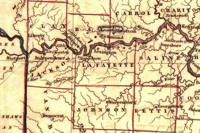
In 1838, at the time the first German immigrants arrived in the Concordia area, the eastern part of Lafayette County had no organized communities, just a few farms. The only communities were along the Missouri River, namely Lexington (platted in 1822), Napoleon (platted in 1836) and Wellington (platted in 1837).
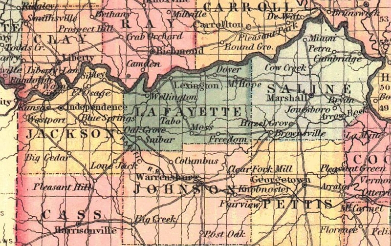
By the mid-1800s, several interesting communities appear west of present day Concordia. One of these was named Moss. The USGS Geographic Names Information System (GNIS) lists Moss as a small village on the banks of Davis Creek. However, the exact location of the settlement is uncertain. Based on the various maps in which it is shown, it apparently was in the general area of Higginsville Junction (I70 and MO13),
Another community just a few miles west of Concordia was named Freedom. The following account of this community is given in the 1881 History of Lafayette County as follows:
"The town of Freedom was laid out in 1860, by Franklin Mock, on section 9, township 48, range 25. [Note. This is between Mock and Bluejay Rds, north of Borland Rd] The plat was put on record. The first store, a frame building, two stories, 40x24, was erected by Wm. Kane, in which he carried on a general mercantile business. The first dwelling house erected, is the one in which Dr. Belt now lives. Messrs. Davis, Livengood & Son, put up and operated a grist mill, which has since been moved to Aullville. Wesley Cox put up the next store, and kept a stock of dry goods and groceries.
In 1857, three years prior to the platting of the town, a church building was erected by the Christian denomination, at a cost of $1,400. The Methodists purchased an interest in it, and occupied it a portion of the time. It has since been taken down and moved to Aullville, where it is entirely under the auspices of the Christians, the Methodists having a house of their own. Prior to the construction of the Lexington & St. Louis railroad, Freedom was a town of considerable importance; but rapidly declined after it was built and Aullville laid out. Since then every business enterprise, with the exception of a blacksmith shop, owned by L. C.Matthews, has been moved to Aullville. The postoffice was kept at Dr. Wilborn's, for a time, and afterwards in Mr. Kane's store."
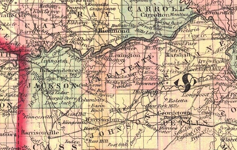
Cooks Store was established as a post office in 1851 and finally appears on the maps of 1860. Colton's map of 1872 suggests that Cook's Store was a significant transportation hub in the area. Besides the railroad, there were six different roads to the communities of Dover, Mt. Hope/Waverly, Elmwood, Georgetown (Sedalia), Warrensburg, and Freedom/Tabo.
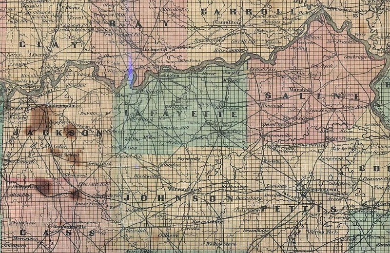
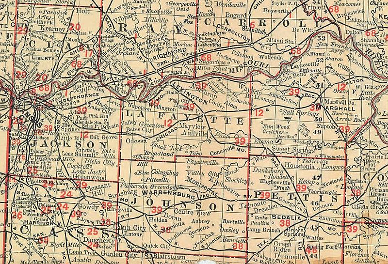
The name Concordia was approved by the Postmaster General in 1865 and the town was platted in 1868, but it is first found on Coltons 1872 map (which was a revision of one of his earlier maps). Interestingly, Aullville was also added on this same map, but named Aullsburg. After the railroad was completed through the area, the General Land Office map of 1878 clearly shows Concordia and Aullville along the rail line. Note that Sweet Springs was still known as Brownsville at that time.
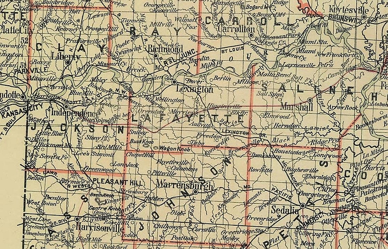
Finally, the Rand McNally map of 1898 shows most of the communities in Lafayette County by their current names, including Alma and Corder.
| Description: |
| Mao of Lafayette County when first German settlers arrive in Concordia area. |
|
| Filesize: |
432.62 KB |
| Viewed: |
16568 Time(s) |
|
| Description: |
| Communities of Freedom and Moss shown west of present day Concordia in 1855 map. |
|
| Filesize: |
415.32 KB |
| Viewed: |
16568 Time(s) |
|
| Description: |
| Cook's Store shown on 1860 maps. |
|
| Filesize: |
436.79 KB |
| Viewed: |
16568 Time(s) |
|
| Description: |
| Concordia added to Colton's 1872 update of earlier map. |
|
| Filesize: |
460.91 KB |
| Viewed: |
16568 Time(s) |
|
| Description: |
| Concordia and Aullville shown along Lexington branch of MoPac rail line in 1878 Geheral Land Office map. |
|
| Filesize: |
494.95 KB |
| Viewed: |
16568 Time(s) |
|
| Description: |
| 1898 RandMcNally map shows most of the current day communities. |
|
| Filesize: |
199.63 KB |
| Viewed: |
16568 Time(s) |
|
|
|

